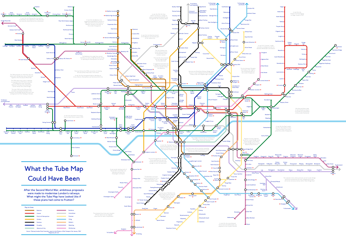
The map above shows what the Tube Map might have looked like had proposals from 1946 had been implemented. The plans are nothing if not ambitious, especially for a country that still had rationing in effect following the devastation of World War 2.
The source for these plans was the Railway (London Plan) Committee: report to the Ministry of War Transport 21st January 1946.
Some highlights include:
- The Northern Heights Plan extending the Northern Line all the way to Bushey Heath.
- The addition of the following lines: Golders, Bankbone, CrickleFleet, Finsmoor, Viking, Watborn, Waterling, Wimbleclap. (Elements of which can be found in many current or proposed plans)
- No Victoria, Jubilee, or Hammersmith and City lines (Metropolitan line is there, but shown in Green)
- Metropolitan line going all the way Aylesbury and Central line going all the way to Ongar.
- No Heathrow Extension
- No DLR or other similar rail projects in the Docklands.
- Massive new interchange station at Tower Bridge Road
- Embankment station still being called Charing Cross and the existence of Trafalgar Square and Strand stations.
- Many new stations including: Mount Pleasant, Ludgate Circus and Millbank.
- The continued existence of many closed stations including: Aldwych, Holborn Viaduct, South Acton, and Shoreditch.
- The Mainline terminals at Charing Cross, Blackfriars, Cannon Street and London Bridge would have been removed.
- Still no Bakerloo line extension south from Elephant and Castle.
Find anything else you think is interesting? Then please leave a comment below:

Youtube says
I like the efforts you have put in this, regards for all the great posts.